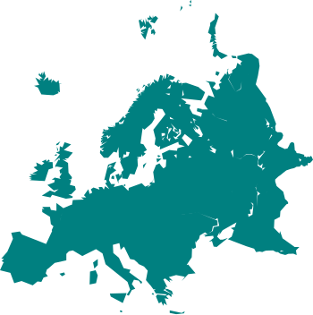
tóng-àn:Cartography of Europe.svg

此 SVG 檔案的 PNG 預覽的大小:350 × 351 siōng-sò͘。 Kî-thaⁿ--ê kái-sek-tō͘: 239 × 240 siōng-sò͘ | 479 × 480 siōng-sò͘ | 766 × 768 siōng-sò͘ | 1,021 × 1,024 siōng-sò͘ | 2,042 × 2,048 siōng-sò͘.
原本的檔案 (SVG ùng-giông, chék-cháung: 350 × 351 chuông-só, ùng-giông duâi-nâung:31 KB)
Tóng-àn ê le̍k-sú
Chhi̍h ji̍t-kî/sî-kan, khoàⁿ hit sî-chūn--ê tóng-àn.
| Ji̍t-kî/Sî-kan | 細張圖 | 寸尺 | Iōng-chiá | soat-bêng | |
|---|---|---|---|---|---|
| hiān-chāi | 2021-nî 3-goe̍h 24-ji̍t (pài-saⁿ) 13:59 |  | 350 × 351(31 KB) | PastelKos | Reverted to version as of 23:02, 23 May 2020 (UTC) so as to match with the other "cartography of ___" maps |
| 2021-nî 1-goe̍h 21-ji̍t (pài-sì) 12:53 |  | 350 × 351(31 KB) | Est. 2021 | Reverted to version as of 15:33, 6 January 2010 (UTC) | |
| 2020-nî 5-goe̍h 23-ji̍t (pài-la̍k) 23:02 |  | 350 × 351(31 KB) | Sittaco | Reverted to version as of 00:20, 12 September 2009 (UTC) | |
| 2010-nî 1-goe̍h 6-ji̍t (pài-saⁿ) 15:33 |  | 350 × 351(31 KB) | Hayden120 | Changed colour to blue; a colour commonly associated with Europe. It also matches the style of 'Portal:Europe' on the English Wikipedia. | |
| 2009-nî 9-goe̍h 12-ji̍t (pài-la̍k) 00:20 |  | 350 × 351(31 KB) | TownDown | {{Information |Description={{en|1=x}} |Source=Own work by uploader |Author=TownDown |Date= |Permission= |other_versions= }} Category:svg |
Tóng-àn sù-iōng ê chōng-hòng
Bô poàⁿ ia̍h liân kàu chit tiuⁿ iáⁿ-siōng.
tóng-àn hō͘ lâng sái--ê chōng-hóng
Ē-kha--ê kî-thaⁿ wiki ēng tio̍h chit--ê tóng-àn:
- ar.wikipedia.org hō͘ lâng ēng--ê chêng-hêng
- بوابة:ألمانيا
- بوابة:ألمانيا/بوابات شقيقة
- بوابة:إيطاليا
- بوابة:إيطاليا/بوابات شقيقة
- بوابة:فرنسا
- بوابة:إسبانيا
- بوابة:النمسا
- بوابة:البرتغال
- بوابة:سويسرا
- بوابة:كرواتيا
- بوابة:كرواتيا/شقيقة
- بوابة:بلغاريا
- بوابة:بلغاريا/شقيقة
- بوابة:المجر
- بوابة:المجر/شقيقة
- ويكيبيديا:مشروع ويكي الاتحاد الأوروبي
- بوابة:النمسا/شقيقة
- بوابة:اليونان
- بوابة:اليونان/شقيقة
- بوابة:الدنمارك/بوابات شقيقة
- بوابة:الدنمارك
- بوابة:رومانيا/بوابات شقيقة
- بوابة:رومانيا
- بوابة:ألبانيا/بوابات شقيقة
- بوابة:ألبانيا
- بوابة:مقدونيا الشمالية/بوابات شقيقة
- بوابة:مقدونيا الشمالية
- بوابة:صربيا/بوابات شقيقة
- بوابة:صربيا
- بوابة:البلقان/بوابات شقيقة
- بوابة:البلقان
- بوابة:كوسوفو/بوابات شقيقة
- بوابة:الجبل الأسود/بوابات شقيقة
- بوابة:الجبل الأسود
- بوابة:كوسوفو
- بوابة:البرتغال/بوابات شقيقة
- بوابة:المتوسط
- بوابة:المتوسط/بوابات شقيقة
- بوابة:ألبانيا/شقيقة
- بوابة:إسبانيا/بوابات شقيقة
- بوابة:سويسرا/بوابات أخرى
- بوابة:فرنسا/بوابات شقيقة
- بوابة:دورتموند
- بوابة:دورتموند/بوابات شقيقة
- bn.wikipedia.org hō͘ lâng ēng--ê chêng-hêng
- cs.wikipedia.org hō͘ lâng ēng--ê chêng-hêng
- de.wikipedia.org hō͘ lâng ēng--ê chêng-hêng
- el.wikipedia.org hō͘ lâng ēng--ê chêng-hêng
檢視此檔案的更多全域使用狀況。


